
Disaster Response for the Gulf Oil Spill Webinar
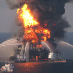
Image by U.S. Coast Guard
Textron Systems will present a webinar demonstrating how remote sensing and geospatial mapping products can be employed to quickly respond to an evolving oil spill.
The event will be on Thursday, March 16. 2017, beginning at 1 p.m. EST.
“Remote sensing and geospatial data play a pivotal role in disaster management allowing responders to analyze the overall situation on a large scale and continually monitor events using satellite imagery and real-time ground truth,” Textron says on its website. “In the case of the Gulf Oil Spill, remote sensing played a critical role in tracking the movement of the oil slick on the ocean surface and its eventual penetration into sensitive coastal areas. This presentation will demonstrate how remote sensing and geospatial mapping products can be employed to quickly respond to an evolving crisis situation.”